Snapzu Earth
Saturday, 21 October 2017
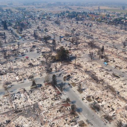
These 360° Drone Maps of California’s Wildfire Damage Are Horrifying
10,000 photos of a charred neighborhood, stitched together. By Samantha Cole.
Continue to article...
No comments:
Post a Comment
‹
›
Home
View web version
No comments:
Post a Comment